Steinmanndlipfad
You can walk, linger, experience and enjoy the 1.5 km long adventure trail to your heart's content. You will learn lots of interesting facts about the area around the center of Switzerland.
1.5 km | ca. 30min
Älggialp is the geographical center of Switzerland, which was determined using state-of-the-art measuring methods in 1988 to mark the 150th anniversary of the Swiss Topography.
As the actual center is located in a steep rock face, the center has been shifted 500 meters to the southeast compared to the calculation. A triangulation pyramid marks the center. The local Steinmanndli club built a wall around it in the shape of Switzerland. From the small hill near the Älggi mountain inn, you can look out over the alpine pastures and the surrounding ring of mountains and enjoy the view of the Mittelland.
The Älggialp is the destination and starting point for many hikes. It is also a stage on the Obwalden high-altitude trail.

You can walk, linger, experience and enjoy the 1.5 km long adventure trail to your heart's content. You will learn lots of interesting facts about the area around the center of Switzerland.

This wonderful circular hike in the heart of Switzerland leads past the geographical center, through beautiful forests to the idyllic Seefeldsee.

The challenging hike to the geographical center of Switzerland is rewarded with a sensational view. If you want to take it a little easier, divide it into two parts and spend the night at the Älggialp mountain inn.
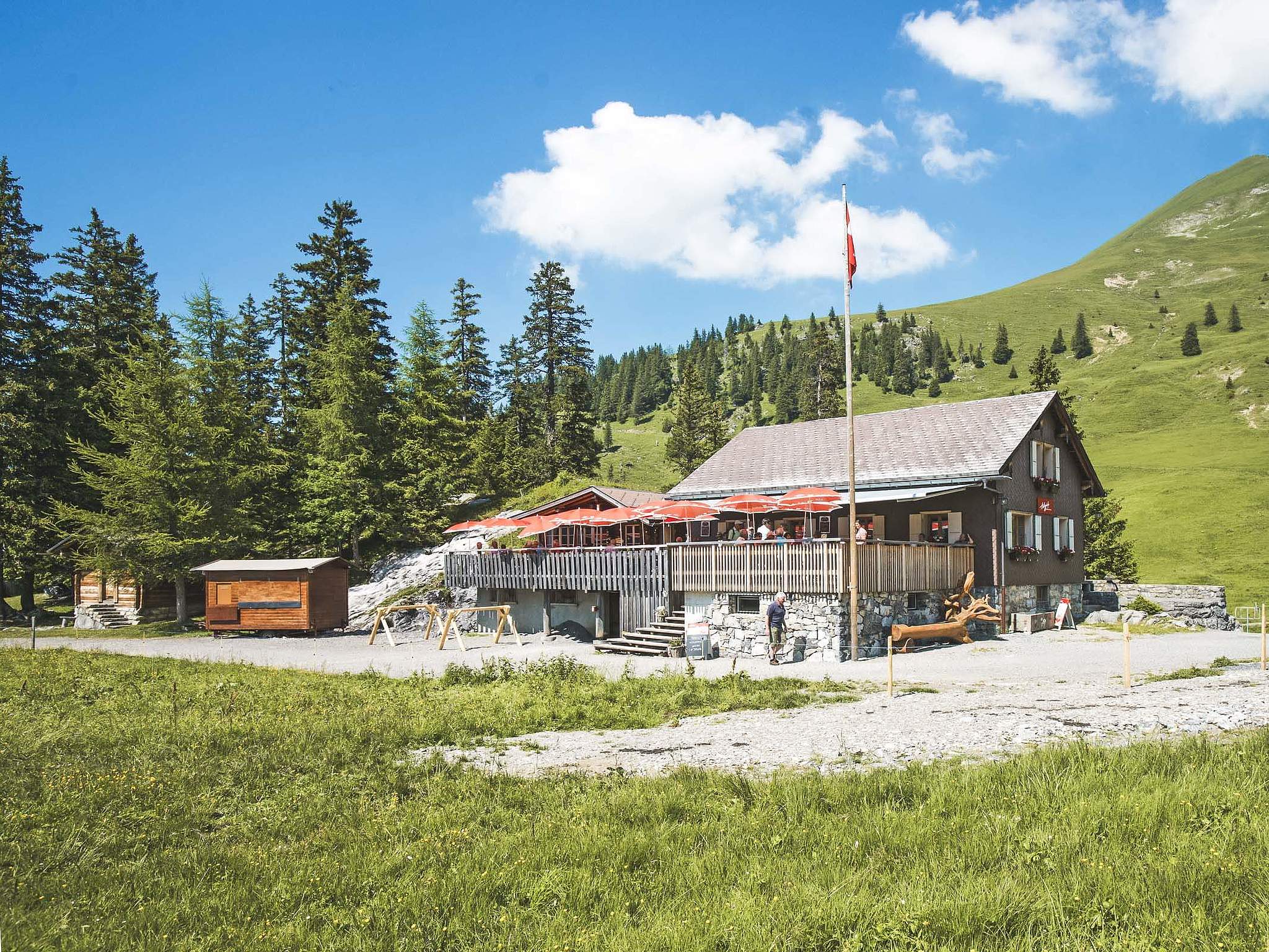
The Älggialp Berggasthaus will remain closed indefinitely due to illness of the tenant, natural disasters and repair work.


The Äggialp can be reached by car, bike or on foot. The road from Blatten can only be used alternately at weekends and on public holidays.
Please note the special traffic regulations on the Älggialp. On Saturdays, Sundays and public holidays there is one-way traffic on the last 5 km.
A narrow and well-surfaced mountain road leads from Sachseln to the Älggialp. The mountain road can be used by minibuses with a capacity of up to 14 people.
The alp is in hibernation from mid-October to June. No winter service is provided during this period. During this time, the infrastructure is also shut down accordingly (no toilets, no water).
The Älggialp is an alpine area in the municipality of Sachseln in the canton of Obwalden and is considered the geographical center of Switzerland.
It stands for pristine alpine landscape, tranquillity and natural experiences far away from heavily frequented excursion destinations.
Access to the Älggialp is via Kerns on a narrow mountain road.
We recommend that you find out about the current traffic regulations before you arrive.
There is a mountain inn on the Älggialp which offers catering and overnight accommodation during the season. The offer depends on the alpine and seasonal operation.
Yes, above the Älggialp lies the Seefeldsee, a natural mountain lake in the Sachsler Seefeld nature reserve.
You can fish in the Seefeldsee (e.g. trout and char), usually from mid-June to mid/end October. Daily permits are available online or at the Älggialp mountain inn.
